About Me

My photo
Florida, United States
June and I retired in June, 2004 and travelled for a year on our boat from Lake Michigan to Florida, then North on the East Coast through Canada, back to Southern Lake Michigan. It was the most amazing trip we have ever taken and one that will be tough to beat. We settled in Florida in the fall of 2005. On April 3rd, 2011, we departed in our Motorhome for the "BIG 2011 PLAN" We've now completed an 18,000 mile, 6 month drive from home in Florida to Northern California, North on the Pacific west coast to Seattle. From there to Alaska - with returning stops in Spokane, Washington - Oregon, Yellowstone, and other sites - then to Fort Wayne, Indiana to visit family, then back South to Florida and home. We have now traded in our motor home and purchased a new 5th wheel travel trailer and truck to continue travelling as long as life will allow. We will keep you informed as much as practical on our new site: www.Rainwatertravel.blogspot.com

Wednesday, June 29, 2011

6/26-28 - Denali National Park & Mount McKinley

 We spent three nights in Denali National Park - wow it's just unbelievable!  On Sunday we watched a sled dog presentation and got to meet all the dogs.  Thirty-one Dogs are maintained here and used during the winter months for transportation of rangers and supplies. No motorized vehicles (snowmobiles) are allowed in order to keep the park as pure as possible.

Monday we took a shuttle bus on the 12 hour tour of the 91 mile long park road that ended at Katinisha, an old gold mining town. No unauthorized vehicle traffic is allowed, only the park tour buses and maintenance and other work vehicles.  We enjoyed this long ride and got to see some unbelievable scenery as well as five Grizzly Bears, Moose, Caribou, and a couple of Golden Eagles.  We did not see any of these close up and the pics are on extreme zoom and not real good quality, but it's what we got.

Hikers, backpackers, can go most anywhere they wish into the park with a wilderness permit. Camper shuttle busses will take you and pick you up along the 91 miles road.

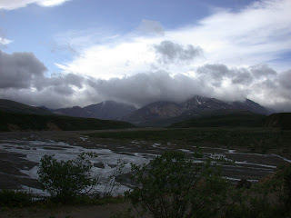
Mount Mckinley at 20,320 ft. is the highest mountain on the hemisphere. We were told that on the day we there, there were 1200 climbers in various stages of the climb to the top.  The entire climb takes 40 days and the success rate is about 60%.  We were fortunate that the mountain was "out" when we visited, as clouds obscure the view 2 out of 3 days.

Alaskan huskies


Mount McKinley

Caribou

Grizzly


It rained all day Tuesday from 8:00 A.M. until a short break around 4:00 when we ventured out and paid a short visit to the science museum which closed at 5:00, then we drove the first 13 miles on the park road that does allow vehicles.

Sunday, June 26, 2011

6/25 - Update

 ADDED SOME PICS 6/28.  The wireless here is very slow so we'll update with pics next time we can get a better connection.

After we dropped our son Kane at the Anchorage airport, we stayed in town at the Golden Nugget RV park and caught up on laundry.  We hadn't had pizza for a while, so on Sunday 6/19 we went to Pizza Hut.

6/20 - Monday:  Today we decided to visit downtown Anchorage, Alaska.  The downtown area is nice with plenty of restaurants and gift shops.  We had a horrible time trying to find a place to park our motorhome.  Anchorage is "not" a place to stop if your travelling via RV.  That's so hard to understand that with the thousands of RV's that have to pass through here to get to the Kenai Peninsula, that the town would want to provide some direction to parking and amenities for the RV'ers.  I suppose they just want other visitors and if you're in an RV - just keep going. We almost did just that when I spied a metered spot on the street at the end, so with the rear of the RV beyond the marked spot, I parked hoping that we would not be ticketed. We were not, but the town didn't make us feel welcome.

Tuesday morning we had an appointment to replace our windshield, so we stayed overnight for free in the Speedy Glass parking lot.

6/21 - We got the windshield replaced and were off by 10:30 A.M. to the little town of Whittier.  On the way we stopped to see Portage Glacier.  Getting to Whittier was exciting. There is a 2 1/2 mile long one-way tunnel that is also the same tunnel the train uses.  Of course when the train is there all other traffic stops.  Vehicles are staged for passage into Whittier on the hour, every hour and traffic leaving Whittier on the half hour.  Vehicles actually drive on the rail tracks.  Whittier is a really neat fishing village that was started years ago by the military. They built the tunnel for the train to bring supplies and vehicles, but was a slow and laborious process. The tunnel was rebuilt for vehicle traffic and opened in 2000, after 9 years of preparation and construction.  Vehicles now shared the tunnel with the railroad. This was made possible when the cruise lines agreed to stop in Whittier if they had a tunnel for vehicles, so with the help of the then Alaska governor, the tunnel was commissioned. We were told the railroad tried to stop the project for purely selfish reasons, but the town in the end won.

Portage Glacier - Kenai Penisula
Tunnel Entrance - 2 1/2 mile tunnel to Whittier
Whittier Tunnel - Exiting


6/22 - Next stop on the Kenai was Homer, another fishing village and very popular with tourists and folks from Anchorage alike. The town was very busy and had lots of parking for everyone.  We stopped at the Salty Dog Saloon, an interesting place that had one-dollar bills tacked to the walls, ceilings, everywhere. The bills are signed and dated by the donor and provides an interesting decor.  We had dinner here, then drove back to the town of Soldotna where we stayed the night for free in a super market parking lot after stocking up on a few groceries.

Homer - Salty Dog Saloon
Helping June shop in Homer Alaska - Wheeeeeeeeee!


6/23 - Seward was the next stop in the Kenai.  We strolled the small downtown area then drove back 8 miles to "Exit Glacier".  After a mile long hike, we could stand within 15 feet of this Glacier that ran along the mountain a few miles.  The area here has dozens of glaciers in the mountains that can be seen and many more you can not see except by air.  This is the closest we have been.   We found a nice camp site in the U.S. Forrest Service campground in the Chugach National Forrest.

June reading about "Exit" Glacier in background

6/24 - Today we headed back 'through' Anchorage, this time we didn't stop - good riddance.  If anyone plans a visit to Alaska - leave Anchorage out of the plan. It's ugly, big, nothing to offer here.  We were stuck when we needed to get the windshield replaced, but Alaska's armpit is definitely Anchorage.

East of Anchorage we stopped and walked to Thunderbird Falls.  It was a nice hike, 2 miles round trip - the falls were small and it was a nice day.  Camped tonight in The City of Houston Campground.

6/25 - It rained all morning and into early afternoon as we drove North towards Denali National Park.  We stayed at the edge of Denali in Cantwell RV park.  On a clearer day Mt. McKinley can be seen, but not today.  McKinley is the highest peak in North America at just over 20,000 feet.  I hope we get to see it while we're here.

Tomorrow we'll get to Denali where we will stay for three nights. We're booked for a 13 hour bus tour into the park. No other vehicles are allowed on this road so to get a good view, the bus is the way to go.


Near Denali National Park

Sunday, June 19, 2011

6/17 - We're in Anchorage

 We left Tok, Alaska this morning at 5:00 A.M. to drive our son Kane to the airport in Anchorage 325 miles distance.  The early departure was decided upon due to a road condition report that suggested we may need a lot of extra time.  There were some bad spots and one stretch of a few miles at 20 MPH, but since it was Saturday there were only two spots that had road crews on the highway so we arrived in Anchorage about 12:30 P.M.   We had lunch with our son and then dropped him at the airport for his flight back to Ft. Wayne, IN.  Our future Daughter-in-law, Dani, stayed in Tok with her Father visiting for another week.

The drive to Anchorage produced some pretty great scenery - here are a couple shots that make you want to just sit and look and wonder at the majestic beauty of it all.

Matanuska Glacier - 102 miles from Anchorage.

Mount Sanford - 16, 237 feet

Mount Sanford

Wednesday, June 15, 2011

6/12 - 14 Made it to Alaska

 We crossed into Alaska for the third time today. This is the main part of Alaska, or some call it the Alaskan interior; as the first town’s in Alaska we visited, Hyder and Skagway, are both in that Southern arm of Alaska, but they’re still Alaska. We haven’t had phone access since June 6th or E-mail access since the 9th. We are now in Tok, Alaska for four nights and will rendezvous with our son Kane and future Daughter-in-law Dani, who flew up from Indiana and are visiting her father who lives here in Tok.


After leaving Whitehorse, the next morning we saw our first Grizzly bear. He was just off the highway in a wide area and scampered into the trees as we drove near. Grizzly Bears are brown and have a distinct look that is different from the black bear family. Their nose is different and they have a distinct hump on their back below the neck. There are some brown colored black bears which we have seen, as well as grays, but this was definitely a Grizzly. He had different moves as he ran into the trees and was a beautiful site. Too bad we didn’t have time to get the camera and turn it on for a picture.

Another first was our seeing the Dahl Sheep. They live high up on the mountains and graze on the steep mountain slopes. We stopped at a visitors center next to what they call “Sheep Mountain” and high up next to a patch of snow, June sited through our binoculars the sheep. It could not be seen without the binoculars, but there it was grazing at the top of the mountain next to the snow patch. Not a great view, but it counts as our first Dahl Sheep siteing.

The last 100 miles of our drive through the Yukon Territory of Canada was beautiful, as have most of the other areas been – The primary difference is the road condition. This area was also one of the most challenging for the builders of the Alaska Highway due to the permafrost. The ground below is permanently frozen and does not provide the base needed for a reliable road. Locals say it was actually kept better before they tried to pave the road a number of years back. They could simply run a road grader and smooth it out when needed. Whether that’s as simple as it sounds I can’t say, but I do know it was bad. A lady at the Beaver Creek welcome center said the road here is the worst its’ been in years due to the extra cold temperatures last winter (global warming? – I don’t believe it - and from what we've seen on the geological history, Earth has been through cooling and warming cycles for millions of years).....  Off and on for miles we moved along at 10 MPH so we wouldn’t get shaken too bad. The bad spots are marked with orange flags so you can prepare – none-the-less, with all the shaking and stones, my windshield was cracked and as I drove I watched it stretch from a three inch crack to now about a 20 inch jagged crack form the base of the windshield moving upward. I have arranged for a replacement when we get to Anchorage next week.

Window Crack w/ shadow (still growing)

A good spot in the road


We crossed into Alaska at the border crossing at 1:45 P.M. Alaska time (5:45 Eastern Time – 4 hrs. difference). A while later we stopped at the Tetlin National Wildlife Refuse Visitor Center and decided to stay the night at their Deadman Lake Campground, 1 ½ miles off the highway. This was a free campground and at 7:00 P.M. a Park Service employee, Cora, conducted for the campers a nice presentation of her life and provided us with materials to make post cards using poster paper and wildflowers. Cora, who is retiring next year, told us she was a native to this land and was raised by her mother along with 5 siblings. Her father died when she was three. They lived in a frame dwelling with canvas tops and sides, insulated with pine boughs and other natural materials. Remember, it gets up to 80 degrees below zero in the winter months. She said she never recalls ever being cold or being hungry. They dressed in animal skins and clothing her mother made and heated with wood they cut and dragged to the dwelling with the help of their sled dogs. They lived in a very small place with one other family down the road that was about 9 miles from what is now the Alaskan Highway.  Her mother traded animal skins for some of the necessary staples and supplies to sustain their needs.  She did not know English until her mother made her go to an Indian school when she was six. She said she remembers that learning English was very hard, but did learn and went on to school and is now a National Park Service Naturalist. She still speaks her native language often, and her children understand the language but don’t use it themselves as all of the people around them today speak English.

Cora
June w/ mosquito net and wildflower cards we made
Rainbow


"Good"  Road

Tuesday, June 14, 2011

6/7 - 11 Whitehorse, Yukon Territory

 We spent 5 days and 4 nights in Whitehorse, Yukon Territory. The first night was free, or they call it “dry camping”, in the Wal-Mart parking lot after we stocked up on groceries. Our next two nights were in an RV park while we scouted the local sites. Downtown Whitehorse is pretty small, about 3 blocks wide and 8 blocks long, but it’s the largest city and the capital of the Yukon Territory. Every day in the small city park, ¼ block, they provide free entertainment. The first day was a group of natives, performing native songs and dancing. The next day we returned and were entertained by old time fiddles and a guitar.


Downtown Whitehorse, Yukon Capital


After lunch at Tim Horton’s, we drove to Miles Canyon and the suspension bridge over the Yukon River gorge where we hiked along the Yukon River where gold seekers of the late 1800’s used river pilots to help them through the canyon on their way to certain riches; which wasn’t to be for the vast majority.

Yukon River suspension bridge at Miles Canyon


June on suspension bridge

Our third night, after two nights in the RV Park, we stayed again in the Wal-Mart parking lot. It rained most of the night and all day, so we visited a couple museums. The Yukon transportation museum; a history of transportation in the Yukon from the gold rush days to more recent times which placed emphasis on airplane travel and the Alaska highway.

We then visited the Yukon Beringia Interpretive Center. Beringia is the name given to that large area of ice and land that at one time connected Alaska to Russia, and was much larger than Alaska today. The history was pretty fascinating as it explained how animals crossed what are now the Bering straits, evidence through excavations, and geological studies of the earth’s movement, etc.

While the rain was subsiding, we took a 4:00 tour of Yukon Brewing, a very small brewery with claims as being the number one beer in the Yukon. At the end of the tour, we were able to taste each of 8 different beers they make here. After this tour, it was just a couple blocks to the Wal-Mart lot so we took advantage of the rate, $0, and felt safer with less driving after all that beer tasting.

Whitehorse Walmart


Day 5 was at the Yukon Arts Center where the Kluane Bluegrass festival was being held. We drove over at about 9:00 A.M. to get a good spot and found the lot virtually empty, except for a couple other RV’s. Entertainment was scheduled to begin at 10:00 in an outdoor tent, so at 9:45 we strolled over to the tent that was set up with about 20 chairs and found a couple good ones (we were first to arrive) and listened to Dill & The Pickles play mostly Irish songs until 11:00. By then the crowd had swelled to maybe twenty or so dedicated bluegrass fans.


We did get to play along in what they called a “Slow Jam”, designed for beginners, but we all had fun, all 12 of us, along with an audience that looked like 30 waiting for the 12:00 show to start in the auditorium. June and I walked to the RV for lunch, then back to the tent at 1:30 where a contest was scheduled for bands to compete for a place on next year’s stage at this same event. The winning group was all female, a guitar – bass – banjo – mandolin – fiddle; and, they were really very good. These professional sounding ladies took first place by a landslide. Oh, they were the only entry, but they were very good anyway.

Contest Winners

After the contest, we decided to head out of town and find a spot to Dry Camp one more night, which we did find a good spot in a very large gravel turnout on the Alaska Highway about 40 miles outside of Whitehorse. We had two other RV’s and a tent at the other far end of the area, plus wall to wall mosquitoes. We were fairly well protected inside, but some of those pesky things did find their way in but met their bloody end by my hand and a fly swatter.

Wednesday, June 8, 2011

6/4 - Fire's out - Skagway, Eagles, Whales, Bears

Shortly after our last post, we learned the road would be open "with an escort", so we departed Dease Lake and drove 70 miles north to a barracade on the highway.

We were the first two RV's to arrive at the barracade and were told the caravan had left just 15 minutes earlier and we would have to wait for the next group.  We waited for two hours as others arrived to wait, and were then escorted through the fires on a 50 mile, hour long drive to the boundary of British Columbia and the Yukon Territory.

Here are a couple of pics that don't really do justice to the devastaion.

2 hr. wait at road block for escort vehicle through forrest fire
Fire Damage from day before
Smoldering fires went on for 30 miles!


Being in the middle of a forest fire was a new experience. We could see small hot spots that were still burning and could smell the smoke 70 miles south of the fire as we drove to the road block.  From the British Columbia Web site we learned that these fires are a natual way of life up here and they experience in BC over 200 fires "Every Day" somehwhere in the province.  That's hard to imagine, but they say it's the way it is. Just about all of these are caused by lightning.

ON TO SKAGWAY

After the drive through the fire damaged area, we stayed overnight in a large gravel highway pull-out area and spent the night on the Alaskan Highway, Route 1.  The next day, 6/4, we drove 250 miles to Skagway, Alaska, located in that southern arm of Alaska where all those in the gold rush of 1898 landed to start their trek throught he wilderness to the klondike where they were conviced they would find gold.  Most did not find any, but the stories are fascinating.  Read the book "Alaska" the chapter on "Gold" for a real appreciation of what this was all about.  The last 50 miles of our drive to Skagway was gorgeous!  And, the last 15 was extremely steep and mostly downhill from 3200 ft. above sea level, to Skagway at near zero sea level. 

On Sunday, 6/5, we took a passenger ferry/tour boat on a day trip to Juneau, Alaska.  Juneau is the capital of Alaska and the only way to get there is by plane, boat, or birth canal. The boat ride to Juneau was 3 hrs, and that included several stops to see the humback whales, dolphins, otter, seals, sea lions of a couple different varieties, and "Hundreds" of Eagles.  We have never seen so many eagles in one place - in fact, there were more eagles in one spot than we have seen in total our whole life.  Our visit to Juneau was about 5 hours and that included a bus ride to Mendenhall Glacier, then the return trip of about 3 hrs - this was a worthwhile experience! ....... Here are a few pics......


View from the Road to Skagway - Rt. 98

Eagle #1
Sea Lions

Humpback Whale Fins

Humpback Whale

Mendenhall Glacier - Juneau

Eagles #2,3,4,5,6

Juneau - local meeting place

View from ferry of lighthouse near Skagway

Our next day in Skagway was spent touring the town, which is there only for tourists - most of whom arrive on the large cruise ships from all over the world.  We are told they can accomodate up to five of the ships at a time.  While we were there, there were only one or two at a time.  The day morning we left, there were three.  The ships can hold over 2000 passengers  -  multiply that by the number of ships, that's a lot of people looking around. We were fortunate to arrive at a slack time.


One of the many ships that stop in Skagway.

Tonite we are in Whitehorse, Yukon Territory, Canada.  The only highway to Skagway is from Canada and it's the only way out as well.  Skagway was nice, but like I said before - it seems that it keeps getting better as we go along...... Next time I'll let you know about Whitehorse and points beyond......

Skagway from hill above town